

MANASLU CIRCUIT TREK – 10 DAYS
10 Oct 2026 Santosh Gauli
Complete Day-by-Day Trekking Itinerary
Destination: Manaslu Conservation Area, Gorkha, Nepal
Duration: 10 days (compact itinerary)
Highest point: Larkya La Pass (approximately 5,106 m)
Trek difficulty: Challenging to strenuous
Starting point: Kathmandu
Trek ending point: Dharapani
Accommodation: Teahouses and mountain lodges
Best seasons: Spring (March–May) and autumn (September–November)
Trekking style: Guided teahouse trek
INTRODUCTION TO THE MANASLU CIRCUIT TREK
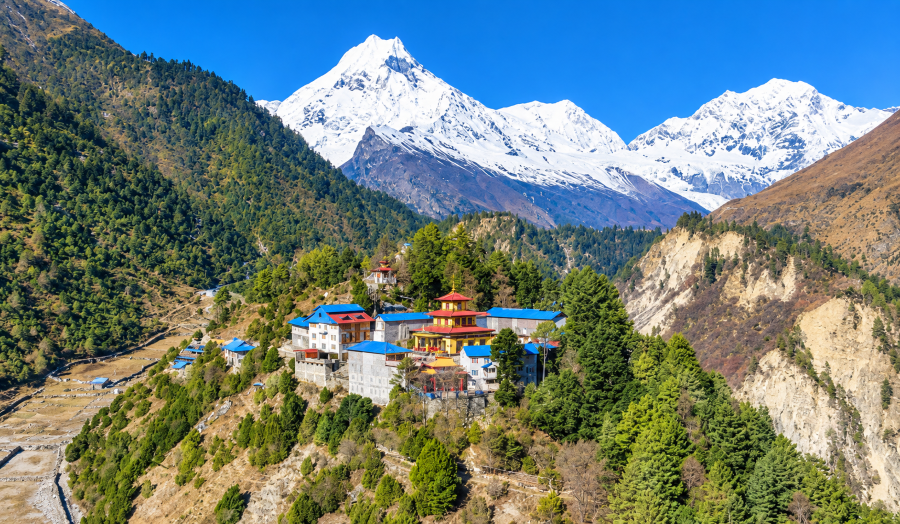
The 10 days Manaslu Circuit Trek is one of Nepal’s most spectacular Himalayan trekking adventures. Located in the northern part of Gorkha District, the route circles Mount Manaslu (8,163 m), the eighth-highest mountain in the world. The journey offers a remarkable combination of dramatic mountain scenery, deep river valleys, traditional Himalayan settlements, Buddhist monasteries, suspension bridges, alpine forests and high-altitude landscapes.
During the trek, you follow the Budhi Gandaki River through remote villages before entering the culturally distinctive Nubri Valley. As the trail gains elevation, subtropical vegetation gradually gives way to pine forests, alpine meadows and rugged Himalayan terrain. The villages of Lho, Samagaun and Samdo provide insight into local Himalayan life and Tibetan-influenced Buddhist traditions.
The highlight of the journey is the crossing of Larkya La Pass at approximately 5,106 metres. From the pass, trekkers can enjoy expansive views of snow-covered peaks and surrounding glaciers when weather conditions are favorable. The route then descends toward Bimthang and continues through forested landscapes to Dharapani, where the trail connects with the Annapurna Circuit region.
Important planning note: Completing the full Manaslu Circuit in only 10 days, including travel from Kathmandu, is extremely demanding. The itinerary below is a compressed outline rather than a universally suitable schedule. Long walking days, limited recovery time and high-altitude exposure make it essential to assess fitness, acclimatization, weather and road conditions carefully. A longer itinerary is preferable for most trekkers.
DAY 01: KATHMANDU TO MACHHA KHOLA (APPROX. 930 M)
Driving duration: Approximately 7–9 hours or longer Trekking duration: No major trekking planned Accommodation: Teahouse in Machha Khola Meals: Lunch en route and dinner at the teahouse
Detailed Itinerary
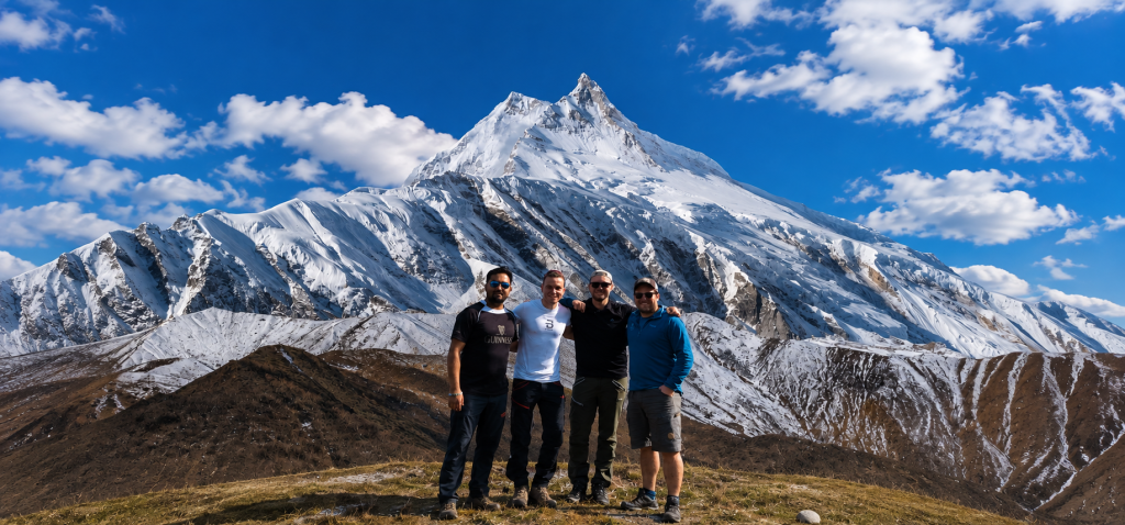
Your Manaslu Circuit adventure begins with an early-morning departure from Kathmandu. After breakfast, meet your trekking guide and travel toward the Manaslu region by road. The journey generally follows the Prithvi Highway before continuing through the rural landscapes of Dhading and Gorkha districts.
Along the way, you will pass terraced hillsides, traditional settlements, rivers, cultivated farmland and small roadside markets. The scenery gradually changes as you leave the busier highway behind and enter the Budhi Gandaki Valley. The road becomes rougher in sections, particularly closer to the trekking trailhead, and travel times may vary depending on traffic, weather and road conditions.
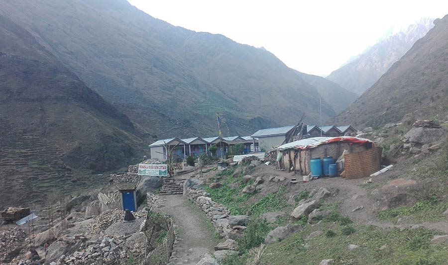
Machha Khola is a small riverside settlement that serves as a common starting point for the Manaslu Circuit Trek. After arriving, check into your teahouse, organize your luggage and review the next day’s route with your guide.
The evening is best spent resting after the long drive, eating a nutritious meal and preparing your trekking equipment.
Highlights
- Scenic drive through the Nepalese countryside.
- Views of river valleys, terraced farmland and traditional villages.
- Introduction to the remote Budhi Gandaki region.
- Preparation for the first day of trekking.
Practical Information
- Starting point: Kathmandu
- Destination: Machha Khola
- Destination elevation: Approximately 930 m
- Transportation: Private jeep or other suitable road transport
- Accommodation: Basic to comfortable local teahouse
- Facilities: Meals, simple rooms and limited charging facilities
Tip: Keep your passport, cash, water, snacks, medication and essential personal belongings in your daypack rather than in your main luggage.
DAY 02: MACHHA KHOLA TO JAGAT (APPROX. 1,340 M)
Walking duration: Approximately 6–7 hours Approximate distance: 17–20 km, depending on the trail and route conditions Accommodation: Teahouse in Jagat Meals: Breakfast, lunch and dinner
Detailed Itinerary
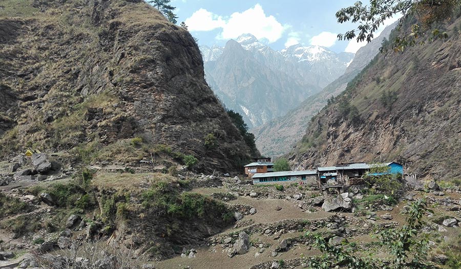
After breakfast, begin trekking northward from Machha Khola along the Budhi Gandaki River. Today’s trail follows a combination of established footpaths, rocky sections, stone steps and undulating terrain above the river.
During the morning, you will pass small settlements, cultivated land and riverside landscapes. The trail crosses suspension bridges and winds through narrow sections of the valley, with occasional uphill climbs and descents. Waterfalls and steep green hillsides contribute to the scenery.
As you progress, the valley becomes increasingly rugged. Depending on current trail conditions, you may encounter sections affected by landslides or road construction, so follow your guide’s instructions and avoid unstable ground.
Jagat is an important settlement along the Manaslu trekking route. The village features traditional stone houses, narrow paths and basic accommodation facilities. It is also an important checkpoint area for trekking permits.
After reaching Jagat, settle into your teahouse, enjoy a warm meal and rest before continuing toward the upper Budhi Gandaki Valley.
Highlights
- Trekking alongside the Budhi Gandaki River.
- Crossing suspension bridges.
- Exploring small settlements and cultivated hillsides.
- Experiencing the increasingly rugged Himalayan landscape.
Practical Information
- Starting point: Machha Khola
- Destination: Jagat
- Destination elevation: Approximately 1,340 m
- Walking duration: 6–7 hours
- Terrain: River trails, stone steps and repeated ascents and descents
- Accommodation: Local teahouse
Tip: Maintain a comfortable walking pace from the beginning. Repeated short climbs can become tiring even at relatively low elevations.
DAY 03: JAGAT TO DENG (APPROX. 1,860 M)
Walking duration: Approximately 6–7 hours Approximate distance: 17–20 km, depending on the route Accommodation: Teahouse in Deng Meals: Breakfast, lunch and dinner
Detailed Itinerary
After breakfast in Jagat, continue trekking through the Budhi Gandaki Valley. The trail passes through terraced farmland, forested hillsides, traditional settlements and steep sections above the river.
Depending on the chosen route, you may pass through or near Philim, one of the larger settlements in the lower Manaslu region. The area is known for its agricultural landscape, traditional houses and mountain surroundings.
Beyond the settlement, the trail continues through forested areas and along rocky valley walls. You will cross suspension bridges and navigate sections where the path rises and falls across the hillside.
As you gain elevation, the landscape gradually becomes more remote. The surrounding hills grow steeper, and the valley begins to feel narrower and more enclosed.
Deng is a small Himalayan settlement that provides an overnight stop before the longer ascent toward Namrung. Facilities are relatively basic, so take the opportunity to rest, eat well and prepare for the following day.
Highlights
- Passing traditional villages and terraced fields.
- Exploring the middle Budhi Gandaki Valley.
- Walking through forested hills and rocky landscapes.
- Experiencing the transition toward the upper Himalayan region.
Practical Information
- Starting point: Jagat
- Destination: Deng
- Destination elevation: Approximately 1,860 m
- Walking duration: 6–7 hours
- Terrain: Forest trails, river crossings, rocky paths and undulating hills
- Accommodation: Basic teahouse
Tip: Carry enough drinking water and snacks for the day’s walk. If rain is expected, use waterproof layers and take extra care on slippery stone steps.
DAY 04: DENG TO NAMRUNG (APPROX. 2,630 M)
Walking duration: Approximately 6–7 hours Approximate distance: 15–18 km, depending on the route Accommodation: Teahouse in Namrung Meals: Breakfast, lunch and dinner
Detailed Itinerary
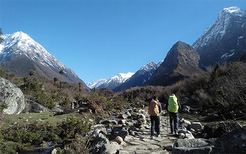
After breakfast, leave Deng and continue toward the upper Nubri Valley. The route gradually gains elevation as it passes through forests, traditional settlements and rocky sections of the Budhi Gandaki Valley.
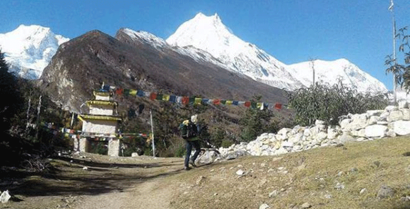
Along the way, you will encounter cultural features associated with the Himalayan Buddhist communities of the region. Mani walls, prayer flags, chortens and traditional stone buildings become increasingly noticeable as you approach the upper villages.
The trail includes several uphill sections, with occasional descents toward river crossings. Forested hillsides and mountain streams provide a scenic backdrop for much of the walk.
As you approach Namrung, the surrounding landscape becomes more distinctly alpine. The village is an important overnight stop because it provides accommodation and an opportunity to rest before continuing toward Lho and Samagaun.
After arrival, check into your teahouse, enjoy dinner and prepare for the next stage, which takes you deeper into the high Himalayan environment.
Highlights
- Entering the upper Nubri Valley.
- Observing traditional Buddhist cultural landmarks.
- Walking through forests and remote mountain settlements.
- Enjoying increasingly impressive Himalayan scenery.
Practical Information
- Starting point: Deng
- Destination: Namrung
- Destination elevation: Approximately 2,630 m
- Walking duration: 6–7 hours
- Terrain: Forested paths, stone steps and gradual uphill sections
- Accommodation: Teahouse
Tip: Start monitoring how you feel at higher elevations. Headaches, nausea, dizziness or unusual fatigue should be reported to your guide.
DAY 05: NAMRUNG TO SAMAGAUN (APPROX. 3,520 M)
Walking duration: Approximately 7–9 hours or longer Approximate distance: 18–22 km, depending on the chosen trail Accommodation: Teahouse in Samagaun Meals: Breakfast, lunch and dinner
Detailed Itinerary
Today’s stage takes you deeper into the Manaslu region and offers some of the most impressive scenery of the trek. After breakfast in Namrung, continue along the trail through traditional villages, cultivated hillsides and mountain landscapes.
The route passes settlements such as Lihi and Sho, depending on the chosen trail. These villages feature traditional stone houses, agricultural terraces and Buddhist cultural landmarks. The surroundings become increasingly open as you gain elevation.
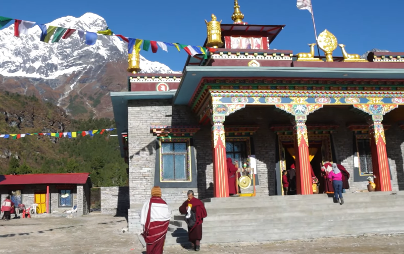
One of the principal highlights is Lho village, which offers impressive views of Mount Manaslu in clear weather. The village’s monastery and surrounding prayer flags create a memorable cultural setting. Take a short break here if time and conditions permit.
Continue toward Shyala, where the landscape opens into a broad mountain panorama. Snow-covered peaks, forested slopes and the surrounding Himalayan terrain make this one of the most scenic sections of the route.
From Shyala, continue toward Samagaun, one of the major settlements in the region. Samagaun is an important stop for trekkers because it offers teahouses, local shops, cultural attractions and access to nearby high-altitude destinations.
This is a particularly demanding stage in the 10-day itinerary. If progress is slow or you experience symptoms of altitude illness, stop at a suitable lower village rather than attempting to reach Samagaun at any cost.
Highlights
- Views of Mount Manaslu from the upper Nubri Valley.
- Visit to the traditional village of Lho.
- Buddhist monasteries, prayer flags and stone houses.
- Scenic landscapes around Shyala.
- Arrival at Samagaun, a major village on the circuit.
Practical Information
- Starting point: Namrung
- Destination: Samagaun
- Destination elevation: Approximately 3,520 m
- Walking duration: 7–9 hours or longer
- Terrain: Mountain paths, gradual ascents and village trails
- Accommodation: Teahouse
Tip: This stage would be more comfortable if divided into two days, with an overnight stop around Lho or Shyala. The compact schedule should not take priority over acclimatization.
DAY 06: ACCLIMATIZATION DAY IN SAMAGAUN (APPROX. 3,520 M)
Walking duration: Rest day with an optional short hike Accommodation: Teahouse in Samagaun Meals: Breakfast, lunch and dinner
Detailed Itinerary
Today is dedicated to acclimatization and recovery. Spending time at Samagaun helps prepare your body for the higher elevations ahead, particularly the route toward Samdo, Dharamsala and Larkya La Pass.
After breakfast, assess your condition with your guide. If you feel well, you can take a gentle walk around the village or visit Birendra Lake, a glacial lake surrounded by dramatic mountain scenery. The walk should be adapted to your energy level and the current trail conditions.
Experienced trekkers who are already well acclimatized may consider a more demanding excursion toward Manaslu Base Camp or Pungyen Gompa. These are optional high-altitude outings, not essential activities for a compressed 10-day itinerary. A strenuous excursion can increase fatigue and undermine recovery before the pass crossing.
Spend some time exploring Samagaun’s traditional architecture, local monastery and surrounding agricultural landscape. The village provides an opportunity to learn about the region’s culture and the daily life of its residents.
The most important priorities are to rest, stay hydrated, eat nutritious meals and monitor for altitude-related symptoms.
Highlights
- Rest and acclimatization in Samagaun.
- Optional visit to Birendra Lake.
- Views of Mount Manaslu and surrounding peaks.
- Exploration of local Buddhist culture and village life.
Practical Information
- Location: Samagaun
- Sleeping elevation: Approximately 3,520 m
- Activity: Rest and optional hiking
- Accommodation: Teahouse
Altitude safety: If you develop symptoms of altitude sickness, do not ascend to a higher sleeping altitude. Worsening symptoms require immediate assessment and may require descent. Severe symptoms such as confusion, loss of coordination or breathlessness at rest require emergency assistance.
DAY 07: SAMAGAUN TO SAMDO (APPROX. 3,860 M)
Walking duration: Approximately 3–4 hours Approximate distance: 7–9 km, depending on the route Accommodation: Teahouse in Samdo Meals: Breakfast, lunch and dinner
Detailed Itinerary
After breakfast, leave Samagaun and follow the trail northward through the upper Budhi Gandaki Valley. Today’s walk is shorter than the previous stages, allowing time to move slowly and enjoy the changing landscape.
The trail gradually ascends through open alpine terrain, yak-grazing areas and scattered stone structures. Trees become less common, and the surroundings are increasingly dominated by broad valleys and rugged mountain slopes.
As you approach Samdo, you will notice the region’s distinctive Tibetan cultural influence in the architecture, local traditions and religious landmarks. Samdo is a traditional high-altitude settlement situated near the Tibetan border region.
After reaching the village, check into your teahouse and have lunch. If you feel well, you may take a gentle walk around the settlement, but avoid unnecessary strenuous activity.
Use the afternoon to prepare for the next stage toward Dharamsala. Check your clothing, water supplies, headlamp and snacks, and ask your guide about the expected weather and trail conditions.
Highlights
- Walking through the upper Budhi Gandaki Valley.
- Views of high Himalayan landscapes and alpine terrain.
- Exploring Samdo’s traditional village environment.
- Preparing for the ascent toward Larkya Phedi.
Practical Information
- Starting point: Samagaun
- Destination: Samdo
- Destination elevation: Approximately 3,860 m
- Walking duration: 3–4 hours
- Terrain: Gradual uphill trail and open alpine terrain
- Accommodation: Teahouse
Tip: Temperatures can drop sharply after sunset. Keep warm clothing accessible and avoid becoming dehydrated in the cold, dry mountain air.
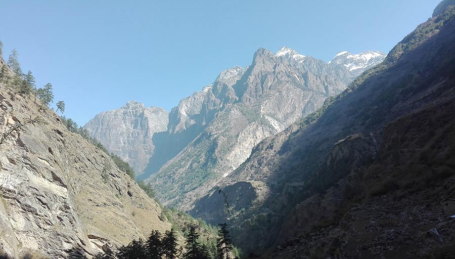
DAY 08: SAMDO TO DHARAMSALA / LARKYA PHEDI (APPROX. 4,460 M)
Walking duration: Approximately 4–5 hours Approximate distance: 6–8 km, depending on the route Accommodation: Basic lodge at Dharamsala Meals: Breakfast, lunch and dinner
Detailed Itinerary
Today’s walk takes you to Dharamsala, also known as Larkya Phedi, the principal staging point before crossing Larkya La Pass.
After breakfast in Samdo, begin ascending through the upper valley. The trail passes through rocky terrain, exposed hillsides and increasingly barren high-altitude landscapes.
As you gain elevation, the air becomes thinner and physical effort increases. Walk slowly, take regular breaks and follow your guide’s pace. The trail may include rough or unstable sections, so remain attentive to your footing.
Dharamsala offers basic mountain accommodation, and facilities can be limited or crowded during busy trekking seasons. On arrival, rest, eat a substantial meal and prepare your equipment for the following morning.
Your guide should assess the weather forecast, snow conditions, visibility and trail safety before deciding whether the pass crossing is appropriate. An early departure is common because it provides more time to cross the pass and descend before afternoon conditions deteriorate.
Highlights
- Gradual ascent into the high Himalayan environment.
- Dramatic views of rugged mountain terrain.
- Arrival at the base of the Larkya La crossing.
- Preparation for the trek’s most challenging day.
Practical Information
- Starting point: Samdo
- Destination: Dharamsala / Larkya Phedi
- Destination elevation: Approximately 4,460 m
- Walking duration: 4–5 hours
- Terrain: Rocky high-altitude paths and exposed slopes
- Accommodation: Basic mountain lodge
Tip: Organize warm gloves, an insulated jacket, waterproof clothing, a headlamp, water, snacks and any personal medication before going to sleep. Do not attempt the pass if you are unwell or conditions are unsafe.
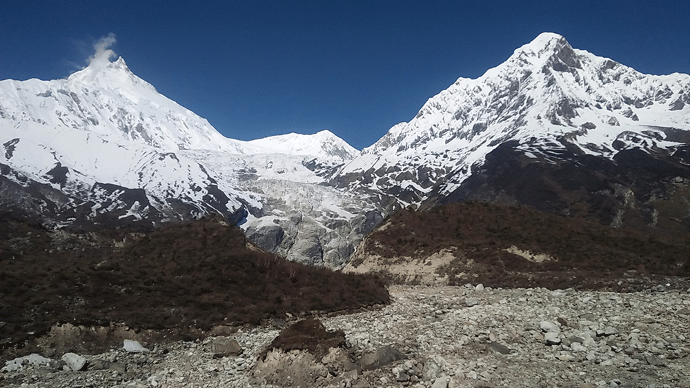
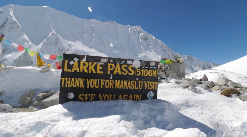
DAY 09: DHARAMSALA TO LARKYA LA PASS (5,106 M) AND BIMTHANG (APPROX. 3,590 M)
Walking duration: Approximately 8–10 hours, sometimes longer Approximate distance: Around 14–18 km, depending on the route and trail conditions Accommodation: Teahouse in Bimthang Meals: Early breakfast, trail snacks or packed lunch, and dinner
Detailed Itinerary
Today is the most challenging and memorable day of the Manaslu Circuit Trek. It involves an early start, a high-altitude pass crossing and a long descent to Bimthang.
Leave Dharamsala before sunrise at a time determined by your guide. The initial section follows a high-altitude trail across rugged terrain. Progress may be slow because of the cold, thin air, rocky ground and possible snow or ice.
As the trail climbs toward Larkya La Pass, the surrounding mountains and glacial landscapes become increasingly impressive. On a clear day, the pass provides sweeping views of snow-covered Himalayan peaks and rugged ridgelines. Prayer flags mark the high point and provide a memorable setting for photographs.
Spend only as much time at the pass as weather and safety allow. Wind, cold and changing visibility can make a prolonged stop uncomfortable.
The descent toward Bimthang is long and may be challenging on the knees, especially after the ascent. Snow, ice and loose stones can make some sections difficult. Follow your guide carefully and use trekking poles where appropriate.
As you descend, the terrain gradually becomes less exposed. Eventually, you reach Bimthang, a beautiful alpine settlement surrounded by dramatic mountain scenery.
Reaching Bimthang marks the completion of the main high-pass section of the Manaslu Circuit.
Highlights
- Crossing Larkya La Pass at approximately 5,106 m.
- Panoramic views of the surrounding Himalayan peaks.
- Experiencing the highest and most demanding section of the trek.
- Descending into the scenic alpine landscape of Bimthang.
Practical Information
- Starting point: Dharamsala
- Highest point: Larkya La Pass, approximately 5,106 m
- Destination: Bimthang
- Destination elevation: Approximately 3,590 m
- Walking duration: 8–10 hours or longer
- Terrain: High pass, rocky trails and a long descent
- Accommodation: Teahouse
Critical safety note: Never attempt to cross the pass simply to remain on schedule. Heavy snowfall, dangerous ice, poor visibility or symptoms of altitude illness may require delaying or abandoning the crossing. Your guide should prioritize safety over the itinerary.
DAY 10: BIMTHANG TO DHARAPANI (APPROX. 1,860 M)
Walking duration: Approximately 6–8 hours Approximate distance: Around 18–22 km, depending on the route Accommodation: Teahouse in Dharapani if staying overnight Meals: Breakfast, lunch and dinner as required
Detailed Itinerary
After breakfast in Bimthang, begin descending toward Dharapani through a changing landscape of alpine meadows, forested hillsides and traditional settlements.
The route generally passes through areas such as Yak Kharka and continues toward the lower valley, with the exact trail depending on current conditions. The descent is lengthy, and your legs may feel tired after crossing Larkya La the previous day.
As you lose elevation, the landscape gradually changes. Alpine vegetation gives way to denser forests, and the air becomes warmer. The trail may include uneven ground, stone steps and sections that become slippery in wet weather.
Depending on your route and pace, you may pass through settlements such as Tilije before continuing to Dharapani. The village is an important junction connecting the Manaslu Circuit with the Annapurna Circuit region.
After reaching Dharapani, you can arrange onward transportation toward Besisahar and Kathmandu. However, reaching Kathmandu on the same day after completing the full descent is not a dependable plan. Road conditions, vehicle availability and the duration of the trek can all affect travel time.
For a safer schedule, stay overnight in Dharapani or another suitable lower settlement and continue to Kathmandu the following day.
Highlights
- Descending from the alpine region toward forested landscapes.
- Observing changes in vegetation and scenery.
- Passing traditional Himalayan settlements.
- Reaching Dharapani and completing the principal trekking route.
Practical Information
- Starting point: Bimthang
- Destination: Dharapani
- Destination elevation: Approximately 1,860 m
- Walking duration: 6–8 hours
- Terrain: Long descent, forest trails and village paths
- Accommodation: Teahouse if staying overnight
- Onward transportation: Local jeep or other road transport, subject to conditions
Important note: Day 10 is a trekking day, not a guaranteed Kathmandu arrival day. If you must return to Kathmandu by the end of Day 10, the entire itinerary needs to be redesigned, with the trade-offs in walking time, acclimatization and safety carefully assessed.
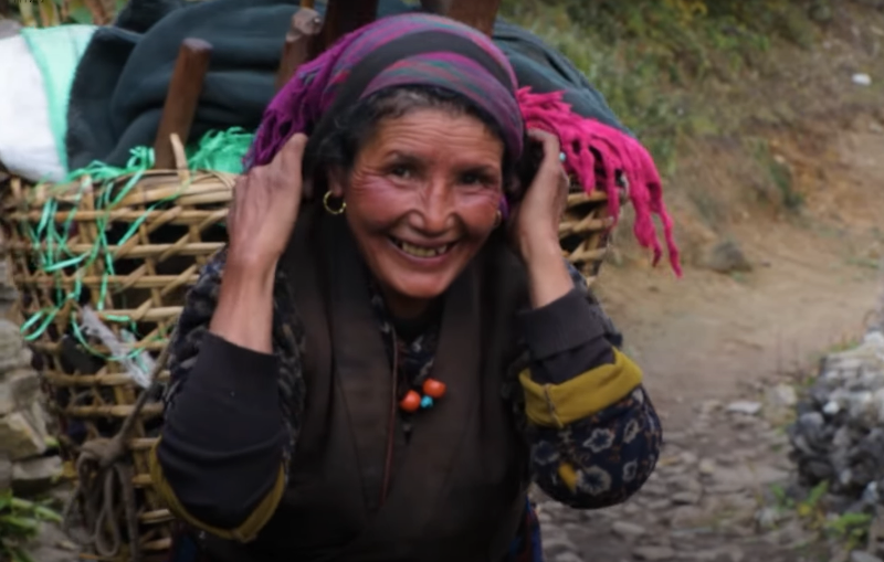
PERMITS REQUIRED FOR THE MANASLU CIRCUIT TREK
The Manaslu Circuit passes through a restricted trekking region, so permits and guide arrangements must be organized before departure.
The principal permits generally required for the standard route are:
- Manaslu Restricted Area Permit (RAP): Required for the designated restricted area. Fees depend on the season and duration of the stay.
- Manaslu Conservation Area Permit (MCAP): Required for entry into the Manaslu Conservation Area.
- Annapurna Conservation Area Permit (ACAP): Generally required for the standard exit route through Dharapani.
Trekkers should confirm the current permit rules, guide requirements, group requirements and applicable fees with an authorized trekking agency or the relevant Nepalese authorities before departure.
BEST TIME TO DO THE MANASLU CIRCUIT TREK
Spring (March–May): Spring is a popular season for trekking in the Manaslu region. Temperatures generally become warmer, and lower-elevation forests may display seasonal flowers. Snow can still affect Larkya La Pass, particularly early in the season.
Autumn (September–November): Autumn is another popular season, often offering clear mountain views and favorable trekking conditions. October and early November are commonly preferred, although weather and pass conditions vary.
Monsoon (June–August): Heavy rain, landslides, muddy trails and road disruptions can make trekking more difficult. Mountain visibility may also be limited.
Winter (December–February): Winter brings very cold temperatures at high elevations, and snow may make the pass difficult or impossible to cross safely. Current trail conditions must be assessed before departure.

ACCOMMODATION AND MEALS DURING THE TREK
Accommodation along the Manaslu Circuit is primarily provided by local teahouses and mountain lodges. Facilities vary between villages, with simpler accommodation generally available at higher elevations.
Rooms are usually basic, often with twin beds and shared bathroom facilities. Hot showers, electricity, charging facilities and internet access may be limited or available for an additional fee.
Common meals include dal bhat, rice, noodles, soups, potatoes, eggs, porridge and other local dishes. Dal bhat is a practical choice for trekkers because it provides carbohydrates and is often served in generous portions.
Trekkers should carry a suitable water bottle and use a reliable purification method. Drinking water should be treated appropriately rather than assumed to be safe directly from mountain streams.
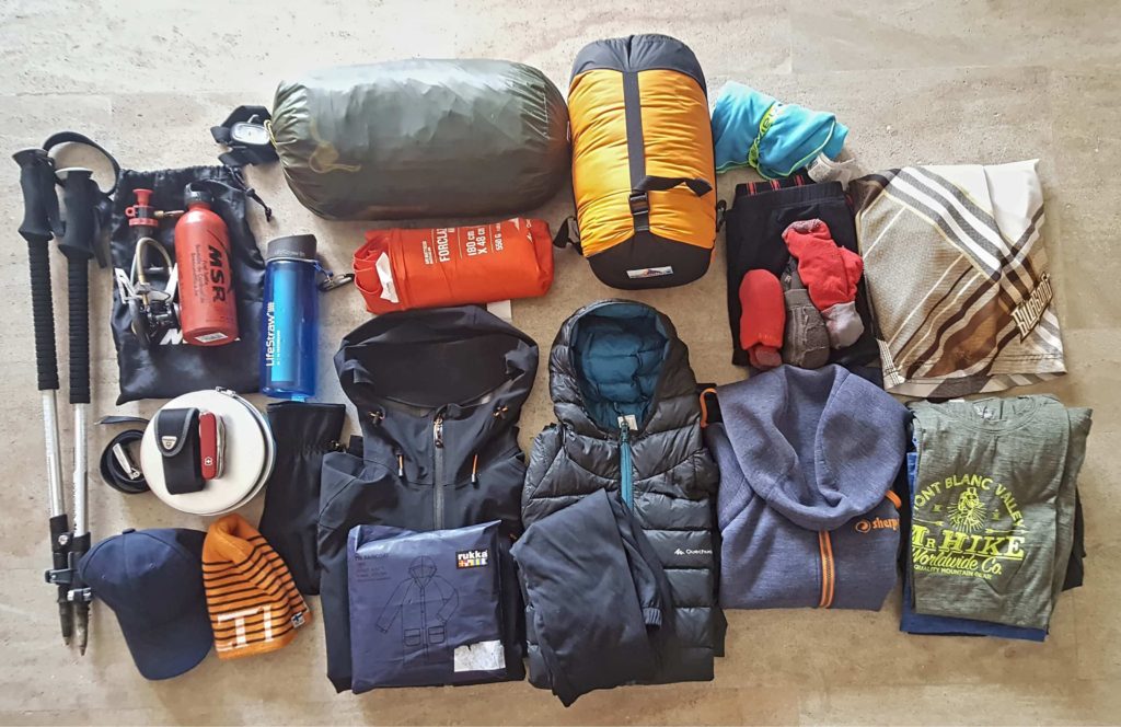
ESSENTIAL PACKING LIST
For a successful Manaslu Circuit Trek, carry equipment suitable for changing temperatures, long walking days and high-altitude conditions.
Clothing
- Moisture-wicking base layers.
- Fleece or insulating mid-layer.
- Warm down or synthetic jacket.
- Waterproof jacket and trousers.
- Trekking trousers and spare socks.
- Warm hat, gloves and neck covering.
Trekking equipment
- Comfortable, broken-in trekking boots.
- Trekking poles.
- Headlamp with spare batteries.
- Daypack and rain cover.
- Water bottles or hydration system.
- Sunglasses and high-SPF sunscreen.
Personal and safety equipment
- Personal medication and basic first-aid supplies.
- Blister treatment and adhesive tape.
- Water purification tablets or filter.
- Phone, charger and power bank.
- Passport, required permits and insurance details.
- Travel insurance that specifically covers high-altitude trekking and emergency evacuation.
PHYSICAL FITNESS AND ALTITUDE SAFETY
The Manaslu Circuit is a challenging trek because of its long walking days, repeated ascents and descents, and high-altitude pass crossing.
Before departure, prepare through regular walking, uphill hiking, stair climbing and endurance training. During the trek, maintain a steady pace, take breaks, eat regularly and stay hydrated.
Altitude sickness can develop even in physically fit trekkers. Symptoms may include headache, nausea, dizziness and unusual fatigue. Do not continue ascending if you develop symptoms of altitude sickness. Worsening symptoms require medical assessment and descent, while severe symptoms such as confusion, loss of coordination or breathlessness at rest require urgent emergency assistance.
Weather and trail conditions can change rapidly near Larkya La Pass. Your guide should assess conditions and make safety decisions based on the actual situation rather than the planned schedule.
FINAL NOTE: IS THE MANASLU CIRCUIT POSSIBLE IN 10 DAYS?
The Manaslu Circuit is an exceptional Himalayan adventure, combining traditional villages, Buddhist culture, remote valleys and spectacular mountain scenery. Its greatest highlights include the villages of Lho and Samagaun, the alpine landscapes around Samdo, and the crossing of Larkya La Pass.
However, the itinerary above is a compressed 10-day trekking outline, not a realistic 10-day round trip from Kathmandu for most trekkers. Day 1 is needed for the drive to Machha Khola, and Day 10 ends at Dharapani rather than Kathmandu. The long Namrung-to-Samagaun stage also makes the schedule particularly demanding.
For a more practical trip, allow approximately 12–14 days or longer, depending on your acclimatization needs, trekking experience, transportation arrangements and contingency requirements. A properly paced itinerary offers more flexibility to enjoy the scenery and respond safely to weather or altitude-related problems.